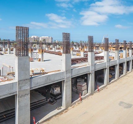
LiDAR (light detection and ranging) has been used in the scanning and data collection for the field for a while, in static and mobile mapping systems. The question is, how is it affecting the electrical contractor? The result of three independent studies—one on SLAM accuracy, one on LiDAR and a time trial video showing LiDar with SLAM (simultaneous localization and mapping) technology, compared to LiDAR on a static scanner, and the difference in static and mobile mapping systems—produced some surprising results.
What are SLAM and LiDAR?
Before we get to the results, though, let’s talk briefly about what LiDAR and SLAM technologies are and how it compares to LiDAR in a static environment.
SLAM is the technique that gives the user the ability to move freely around a job site, and in doing so build a “map” of the area while constantly knowing its location in the map.
When used with a LiDAR camera, SLAM can precisely capture overhead systems such as conduit, bus duct, cable tray and junction boxes. The LiDAR camera uses technology called inertial measurement units (IMUs) to collect distances from lasers emitted from the LiDAR camera. In essence, it shoots a laser to a point and collects and records the distance to the scanner. It does this millions of times a minute, collecting and storing each point.
In a mobile mapping scenario, the user will walk the job site at approximately half-speed, while either holding or wearing the LiDAR camera. As the user walks the area, LiDAR is collecting the points, and the SLAM technology is tracking or mapping the walk. The advantage is that there is no registration (or stitching) of the points—it knows where the user is in relation to the area. When completed, the final deliverable is a point cloud that gets uploaded and processed in the cloud.
In comparison, the static LiDAR scanner would require the user to set up the tripod with a scanner mounted on top, then start the scanning process. This includes auto-leveling the scanner, collecting the LiDAR points and transferring the data collected to a handheld tablet. Once the data is on the tablet, the software of will attempt to auto-stich the scan to the previous scan. If it is unable to stich the two scans together, it would require user input to attempt to manually stich them together.
The results of the combined studies
Now that we have discussed the different type of technologies, and scanning processes, let’s take a look at the results.
Summary of quantified gains: LiDAR + SLAM vs. static scanning
| Metric | Static LiDAR | Mobile LiDAR + SLAM | Improvement |
|---|---|---|---|
| On-site capture time | 2–3 days (for large site, e.g., 100,000 sq. ft.) | 2–4 hours (same site) | 80%–90% faster |
| Number of field technicians needed | 2–3 technicians (setup, registration) | 1 technician (mobile scanning) | 50%–66% labor savings |
| Registration/post-processing time | 1–2 days (manual scan registration) | ½–1 day (automated SLAM processing) | 50% faster |
| Data usability for BIM & coordination | High (survey-grade accuracy) | High (near-survey grade, sufficient for MEP/BIM) | Comparable |
| Access in tight/occupied areas | Limited (requires stationary setup, clear line of sight) | Excellent (wearable/mobile, walkthrough scanning) | Much better access |
The above table shows the difference in collection times, where static LiDAR mounted on a tripod is compared to SLAM LiDAR (mobile mapping systems). The metrics are based on overall capture time, the number of technicians needed for the capture, the processing time once the scan is complete, how accurate the data is and how the scanner performs in a tight or congested area.
Results from our actual time trials were a little better than the above.
| Building | Square footage | Scan time static LiDAR | Processing time (local) | Scan time mobile LiDAR | Processing time (cloud) |
|---|---|---|---|---|---|
| College science building | 31,350 sq. ft. | 420 minutes | 240 minutes | 45 minutes | 60 minutes |
The above table shows actual time recorded by an electrical contractor used in a real-world scenario, with a final deliverable.
About The Author

CHRISTMAN specializes in innovation and construction technology from an electrical contractors point of view. He is passionate about elevating the industry. He can be reached at [email protected].